Appendix 2 – Record of Protected Structures and Record of Monuments and Places
A2.1 Record of Protected Structures
Volume 3B of the Limerick Development Plan 2022 - 2028, sets out the Record of Protected Structures for the Newcastle West Municipal District. A protected structure is deemed, under the provisions of Section 2 of the Planning and Development Act, 2000 (as amended), to consist of the following:
- the interior of the structure,
- the land lying within the curtilage of the structure,
- any other structures lying within that curtilage and their interiors, and
- all fixtures and features which form part of the interior or exterior of any structure or structures referred to in subparagraph (i) or (iii)”.
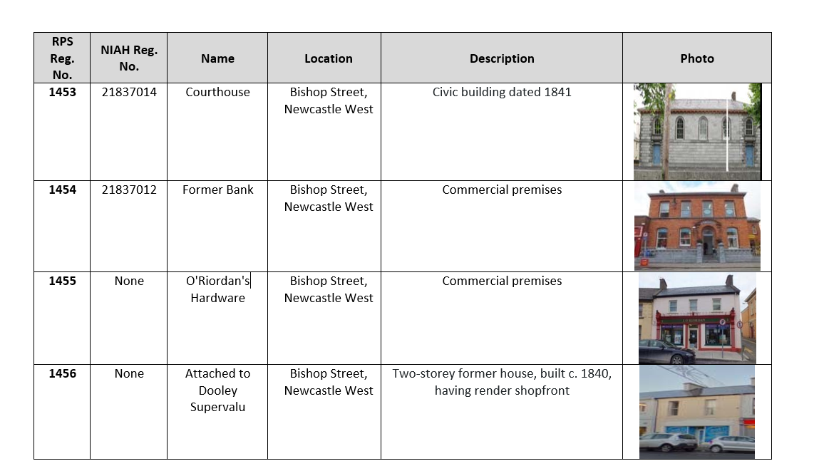
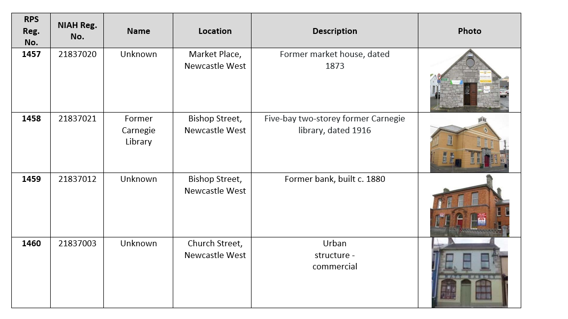
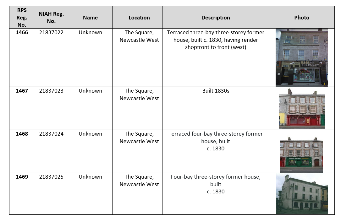
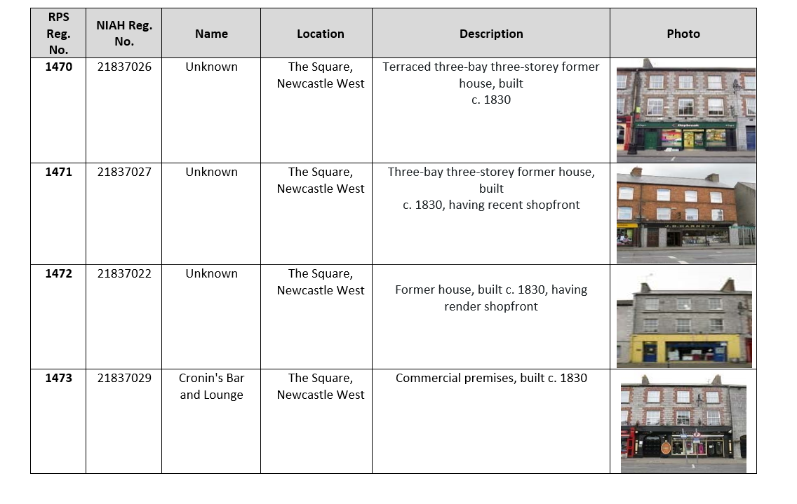
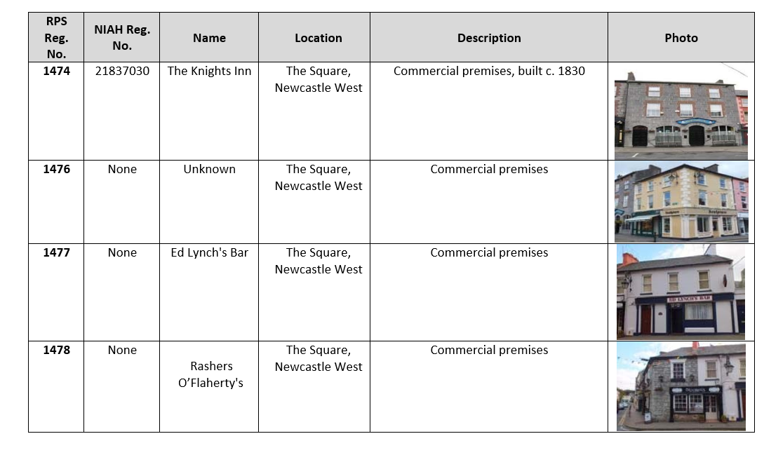
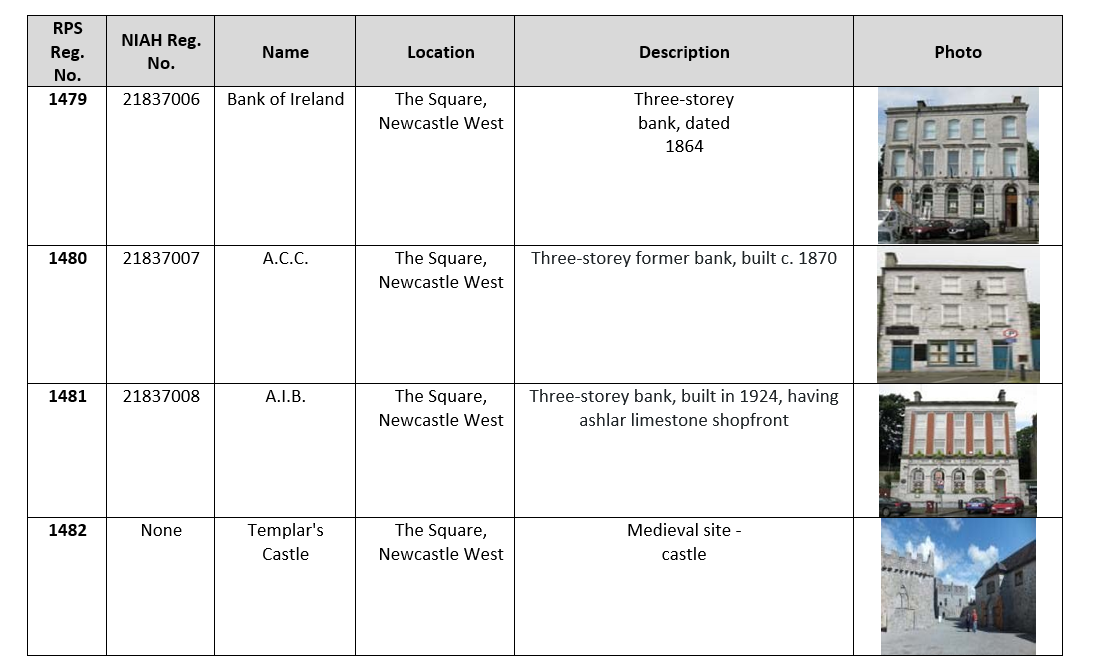
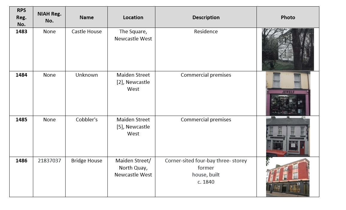
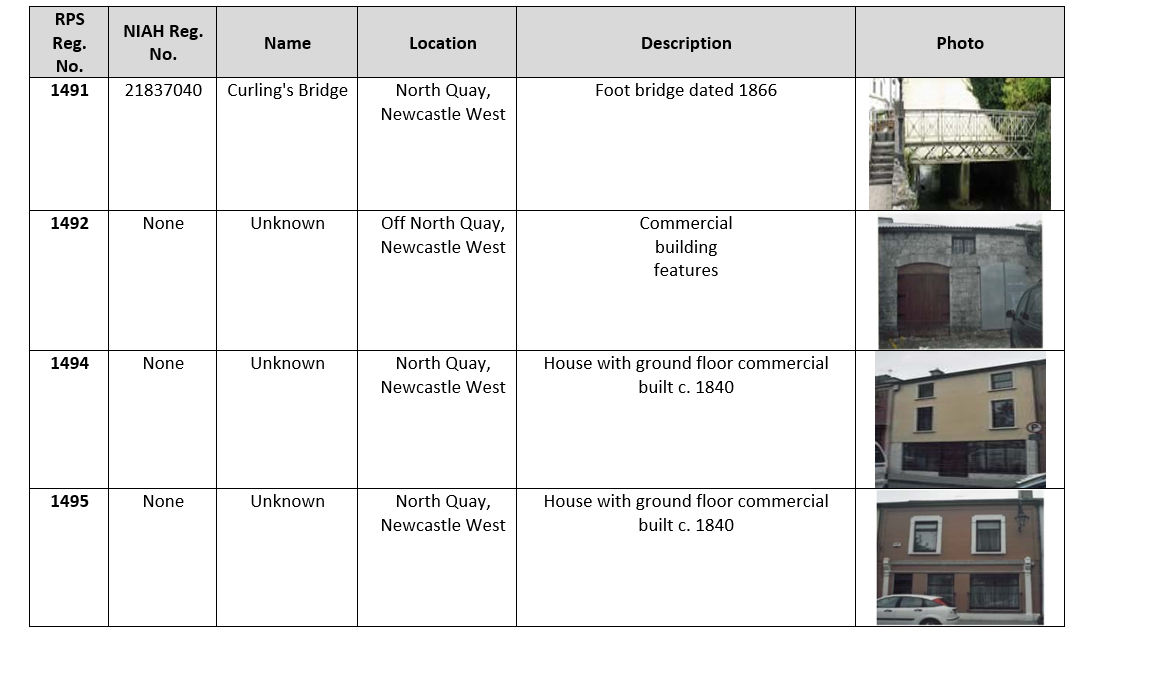
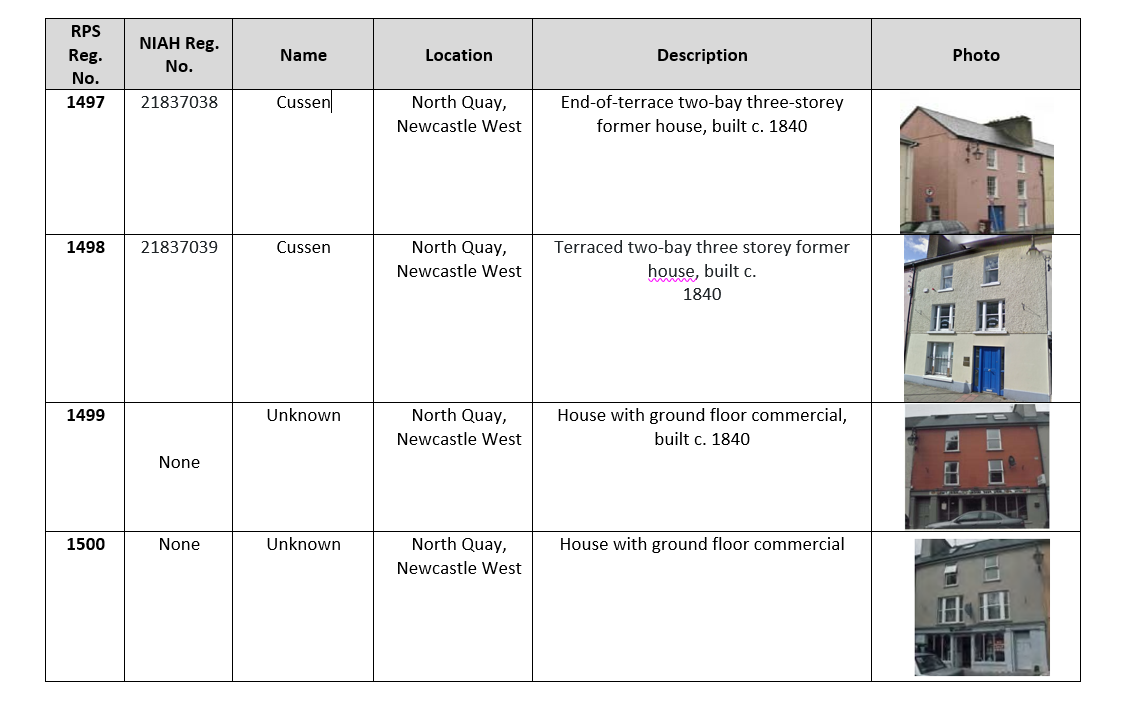
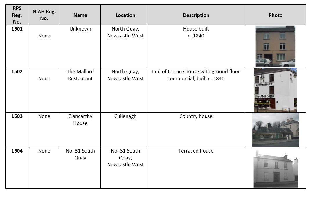
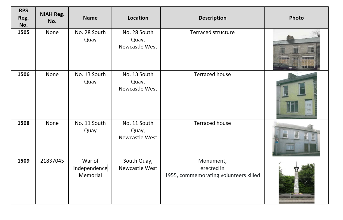
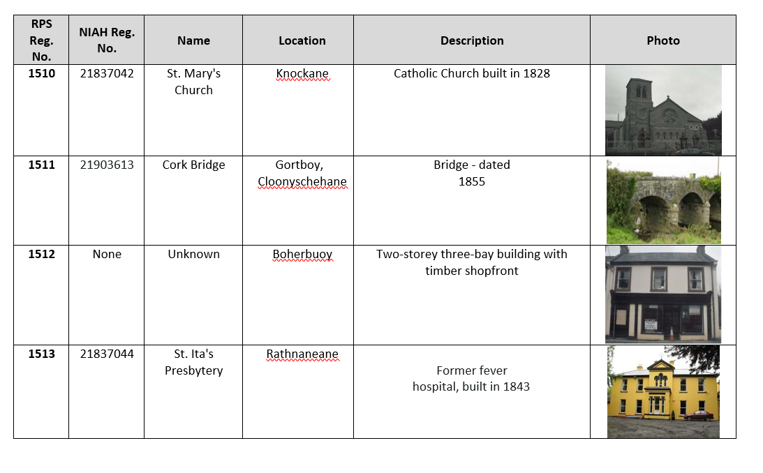
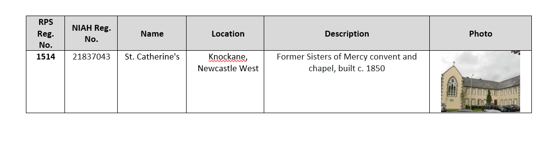
The following table sets out the Record of Protected Structures for Newcastle West as per the Limerick Development Plan 2022.
Table A2.1: Record of Protected Structures


A2.2 Record of Monuments and Places
Archaeological sites are included in the Sites and Monuments Record under the provisions of Section 12(1) of the National Monuments (Amendment) Act, 1994. Section 12(3) of the Act states “When the owner or occupier…of a monument or place which has been recorded under subsection (1) or any person proposes to carry out, or to cause or permit the carrying out of, any work at or in relation to such monument or place, he shall give notice in writing of his proposal to carry out the work to the [Minister for the Environment, Heritage and Local Government] and shall not, except in the case of urgent necessity and with the consent of the [Minister] commence the work for a period of two months after having given the notice.”
Section 16 of the Act prohibits the use or possession of detection devices “in, or at the site of, a monument recorded under Section 12.” The following table lists the Recorded Monuments and Places located in Newcastle West:
Table A2.2: Record of Monuments and Places:
|
RMP Number |
Classification |
Townland |
Location |
|
LI036-069 |
Ringfort |
Ballymackesy |
527756/632389 |
|
LI036-193 |
Ringfort |
Ballymackesy |
527673/632418 |
|
LI036-067001 |
Historic town |
Castle Demesne, Churchtown, Gortboy, Rathnaneane, Knockane |
527895/633831 |
|
LI036-067002 |
Castle |
Castle Demesne |
527874/633708 |
|
LI036-024001 |
Church |
Churchtown |
527479/634438 |
|
LI036-024002 |
Graveyard |
Churchtown |
527480/634439 |
|
LI036-064 |
Ringfort |
Cyllenagh |
527169/633371 |
|
LI036-180 |
Ringfort |
Cullenagh |
527004/633725 |
|
LI036-211001 |
Country House |
Cullenagh |
527651/633647 |
|
LI036-211002 |
Well |
Cullenagh |
527657/633652 |
|
LI036-081 |
Ringfort |
Dromin |
529417/633602 |
|
LI036-072 School |
|
|
528164/634115 |
|
LI036-075 |
Ringfort |
Gortboy |
528433/634165 |
|
LI036-074 |
Ringfort |
Killeline |
528276/632900 |
|
LI036-076 |
Ringfort |
Killeline |
528573/632773 |
|
LI036-077 |
Ringfort |
Killeline |
528636/632689 |
|
LI036-078 |
Designed landscape |
Killeline |
528706/632969 |
|
LI036-079 |
Ringfort |
Killeline |
528956/633069 |
|
LI036-068 |
Ringfort |
Knockane |
527708/633043 |
|
LI036-070 |
Ringfort |
Knockane |
527852/632616 |
|
LI036-210 |
Excavation |
Rathnaneane |
528316/633039 |
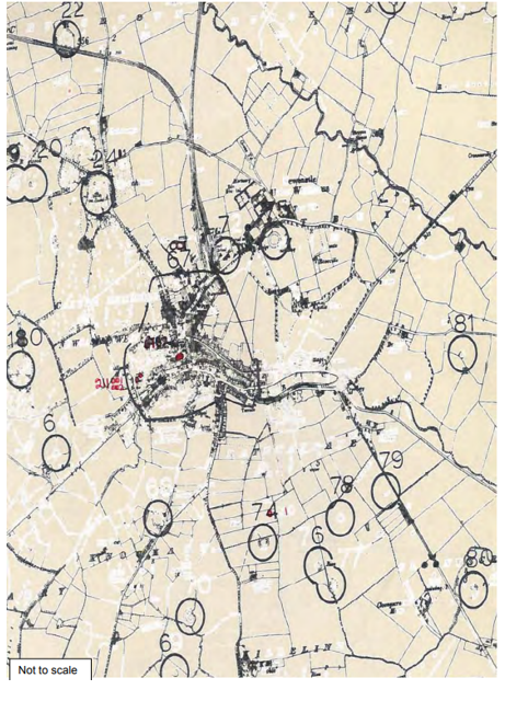
Figure A2.1: Record of Monuments and Places Map