Chapter 7 - Community infrastructure, green infrastructure and recreation
The planning policy for community facilities, and green infrastructure is to:
Ensure that community infrastructure and a range of open space opportunities for passive and active recreation contribute to a vibrant, prosperous urban settlement. This supports the principles of healthy communities, inclusivity and accessibility to facilities for all abilities, and sustainability to ensure that Kilmallock is a greener, cleaner, more welcoming place to live, work, visit and attract investment.
7.1 The importance of community and green infrastructure
National policy recognises the importance of community infrastructure and recreation opportunities to a vibrant community. The collective well-being of an urban settlement is correlated with the quality of the urban environment. Open spaces assist the Council and the community achieve the wider objectives for biodiversity, health and well-being, place-making and identity. Green spaces contribute to the legibility of an urban settlement assisting ones sense of location, direction and orientation. Open spaces can contribute to the intangible values of a community’s sense of pride, civic activities and engagement, and collective ownership. The following policy documents expresses this sentiment at the national level:
- Guidelines for Planning Authorities on Local Area Plans, 2013 and the companion document Manual for Local Area Plans, 2013;
- Framework for Health and Well-being 2013 – 2025 under the Healthy Ireland programme;
- National Youth Strategy 2015-2020;
- Sustainable Residential Development in Urban Areas, 2009;
- Teenspace – National Recreation Policy for Young People 2007;
- Healthy Ireland, and
- Better Outcome Brighter Futures – the National Policy Framework for Children and Young People 2014-2020
- Ready! Steady! Play! – National Play Policy, 2004;
- Quality Housing for Sustainable Communities, 2007;
At a local level policy documents include:
- Limerick and Clare Sports and Physical Recreation Strategy, June 2013;
- Limerick City Council Sports and Recreation Plan 2010 – 2019;
- County Limerick Recreation Strategy and Action Plan 2010 – 2012;
- Healthy Limerick programme launched in 2017;
- The Limerick Cultural Strategy – A Framework 2016-2030;
- Kilmallock Walled Town Public Realm Plan 2009; and
- Limerick Local Economic and Community Plan (LECP) 2016 – 2021;
National planning guidance requires consideration of community facilities and open space when preparing development plans and planning applications. Limerick City and County Council requires developers of housing estates to submit Sustainability Statement and Social Infrastructure (SSSIA) as part of their planning applications. Open space is considered an integral aspect of the local area plan process.
In recent times, the term ‘green infrastructure’ is considered more appropriate when looking at open space provision. This concept is defined as looking at the totality of open space in an urban area, and the opportunities to develop a connected system of the parks, green wedges, green corridors. The connectivity of open space is considered important to address wider sustainable transport/movement goals, and biodiversity principles of the movement of flora, fauna, pollinators and insects. Connected open spaces contribute to a more active and healthy lifestyle providing opportunities to cycle and walk/run at ease with comfort, and safe from traffic. These spaces also have an important role in surface water disposal as they offer a porous, sustainable, and a natural solution to hard surface surface water run-off. Central to Kilmallock’s green infrastructure is the walkway by the East and West Walls, the Famine Memorial Park and the urban park to the north of the town and the riverside park. This proposed LAP zones 23.6 hectare for Open Space and Recreation, and 12.2 hectares for Open Space and Sports Grounds.
Figure 7.1 New pedestrian bridge
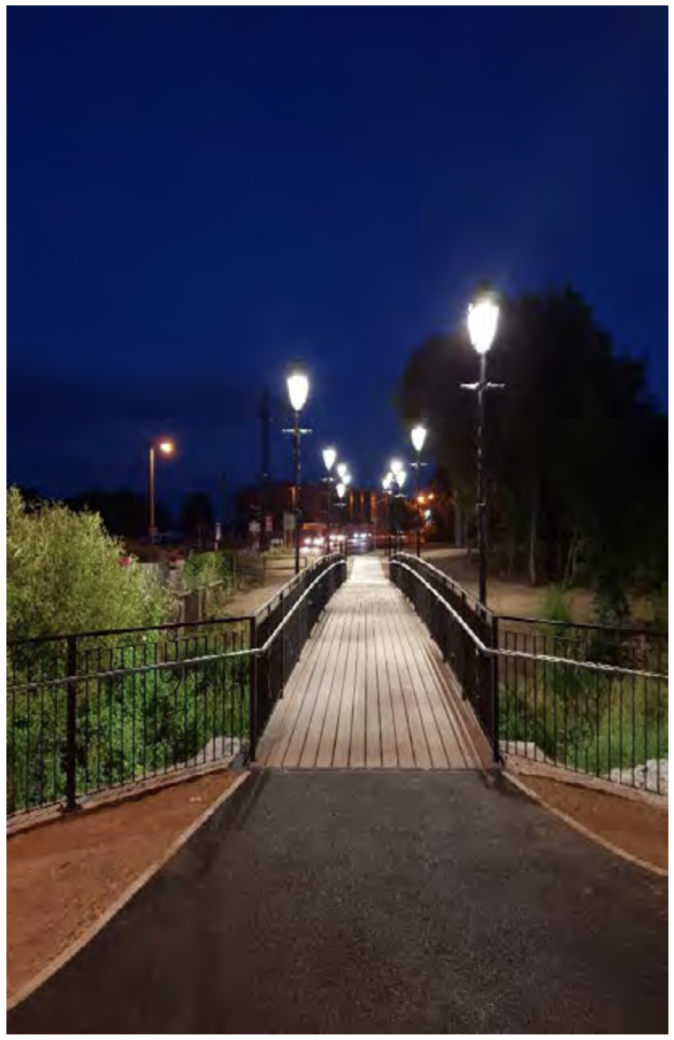 Photo courtesy of Niamh Hayes
The provision of adequate community facilities and green infrastructure are essential elements of sustainable and balanced development. Community facilities include educational, religious, health, recreational and sporting needs and activities. A key objective of the LAP is to ensure that the education and community needs of residents, both new and existing, can be provided for and that expansion of the town will be accompanied by a corresponding expansion of community facilities. Kilmallock offers a number of community/education facilities and services including pre-schools, national schools, a post-primary school, a further education campus, a HSE clinic and day-care centre, public library, district court house, and the Cappamore-Kilmallock Municipal District office. This plan zones 10 hectares for community and education use.
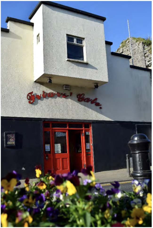
Figure 7.2 Friar’s Gate Theatre – a community cultural space in Kilmallock
Recreational opportunities have been greatly enhanced in the town by public realm works by the town walls, the new footbridge over the River Loobagh and the associated urban park developed by the Council in partnership with the local Tidy Towns since the adoption of the 2009 LAP. There is also the public park on the banks of the Loobagh. This plan zones 23 hectares as public open space and recreation, and 12.6 hectares as open space – sports grounds. The 2009 Kilmallock Plan did not make a distinction between types of Open Space and the zoning assigned related to Open Space and Recreation. It is considered prudent in the review of the plan to separate the zoning types out into Public Open Space and Sports Grounds which give a true reflection of public accessibility or potential accessibility to open space.
In terms of residential development, the Council will require the following:
- Centralised quality open space with adequate natural surveillance as a key consideration of an estate layout when applying for planning permission.
- Ancillary open space due to the configuration of the site shall not be included as the minimum standard of the County Development Plan.
- Archaeological buffers shall not be included in the open space calculation for housing estates when seeking planning permission, and most be additional to designated open space delineated on the layout.
- Attractive natural features should be protected and incorporated into open space and tree planting of native species should be integral in terms of number and location on the space.
- Areas were children may play should be overlooked by fronts of houses to maximise passive surveillance.
- Open space for smaller residential developments such as special needs and age-friendly housing communities will be given more flexibility but subject to high quality design.
Guidance for new residential open space provision is outlined in Table 7.1 below.
Table 7.1 Open space heirarchy
|
Type of Public Open Space |
Area (ha) |
Accessibility from residential units |
Note
|
|
Play lot/ pocket park – primarily catering for play for younger children
|
400sqm – 0.2
|
Every home within 100m walking distance
|
To be provided in housing estates, overlooked with passive surveillance by as many houses as is possible. Not permitted to side or rear of dwellings. Developers will be required to provide a minimum of two permanent play features on site. |
|
Small Park |
0.2 – 2 |
Every residential unit within 400m walking distance
|
To accommodate a small playground with a minimum of 4 play features, kick around space, and passive recreation. Must be overlooked with passive surveillance by as many houses as is possible. Not permitted to side or rear of dwellings. |
|
Local Park |
2 – 20 ha |
Residences to be within 1km
|
To accommodate a wide range of uses including playing pitches, passive recreation and biodiversity areas. |
To align with the policy for open space above the following are the objectives of the proposed Kilmallock Plan based on the themes of; value, quantity, quality, sustainability, conservation and protection.
The objectives for community facilities and open space/ green infrastructure are:
Objective C1 Community, education and childcare facilities
It is the objective of the Council to:
- Ensure that there are sufficient educational zoned land to meet the needs generated by proposed residential developments by requiring the completion of a Sustainability Statement and Social Infrastructure Assessment for residential development of 5 or more dwellings.
- Ensure as practicable and appropriate, that community facilities are located within the town, in the interest of sustainable development. The proposal should demonstrate that the principles of accessibility for all and Irelands Age-friendly Cities and Counties Programme’ were incorporated, and the principles of accessibility for all.
- Establish and implement, in partnership with other providers of public services and the local community, strategies to enhance and support the development of existing and new communities.
- Ensure that all proposal for educational and childcare facilities comply with the development management standards of the County Development Plan.
Objective C2 Protection of lands zoned for open space and encourage active and passive use of open space
It is the objective of the Council to:
- Protect existing open space, by not permitting development which encroaches on open space by reducing the recreational value to the public. in the interest of recreational enjoyment, community health and well-being, flood protection and biodiversity.
- Seek in partnership with other agencies to develop active and passive recreational opportunities, where the need arises considering demographic profile and future demand.
- Lands designated as a buffer for the purposes of archaeological heritage will not be considered as open space requirement of the Development Plan.
- Co-operate with sports clubs, schools, cultural groups and community organisations to provide quality sports and recreational facilities to the community. The Council encourages a multi-use and co-use of facilities of a complementary nature to support more diverse range of sport and recreational opportunities. Proposed development shall demonstrate quality pedestrian and cyclist linkage.
- Ensure residential development incorporates appropriate provision of quality public open space and playlots in accordance to national guidance and any subsequent guidance within the timeframe of the proposed Plan. Open space provision will be proportional to the scale of the number of residential units proposed, consider access to existing open space and of a quality cogniscent of the principles of national guidance including accessibility, personal and child safety, linkage, place-making, and permeability and the hierarchy of open space.
- To ensure that proposals for largescale development on land zoned Enterprise and Employment incorporate active and passive recreational opportunities for employees.
Objective C3: Open space hierarchy
It is the objective of the Council to:
- Require residential development to adhere to the requirements regarding open space within housing estates in accordance with Table 7.1 Open Space Hierarchy in Residential Estates.
- Require applications for residential developments to demonstrate clearly that sufficient consideration has been given by the developer to the provision of functional open space as per DEHLG 2009 guidelines on design of urban residential development.
- The Council will seek to ensure that every new residential unit in new housing estates is located within 100m walking distance of a pocket park / play lot, small park, or local park. Such facilities must be clearly delineated on planning application drawings and demarcated in advance of the sale of any of the units.
Objective C4: New amenity areas/walkways, allotments and community gardens
It is an objective of the Council to:
- Continue to facilitate the development of walkways as indicated on the Amenity Map in Appendix 1 in co-operation with local interested parties including the private, voluntary and public sector. Any proposed development adjacent to such walkways must incorporate connecting pathways into the designated walkway in their design. Developments shall be designed to ensure that properties over look proposed walkways.
- Co-operate with other agencies to enhance and provide recreational and amenity facilities in the area, and
- Facilitate opportunities for allotments or community gardens at appropriate locations.