Please see attachment.
Chapter 12 - Climate Change and Flood Risk Management
Closed18 Jun, 2022, 8:00am - 2 Aug, 2022, 5:00pm
12 Climate Change and Flood Risk Management
Climate change is one of the biggest issues facing Ireland today effecting environmental quality, health, business, and transport. Developments can exacerbate the problems of climate change including flooding by accelerating and increasing surface water run-off, altering watercourses and removing floodplain storage. Means to reduce greenhouse gas emissions and pollutants, and mitigation measures to reduce the frequency of the extreme weather events such as rainfall, dry spells, strong winds, heavy snowfalls are necessary to ensure future society, business, and infrastructure are resilient to climate change.
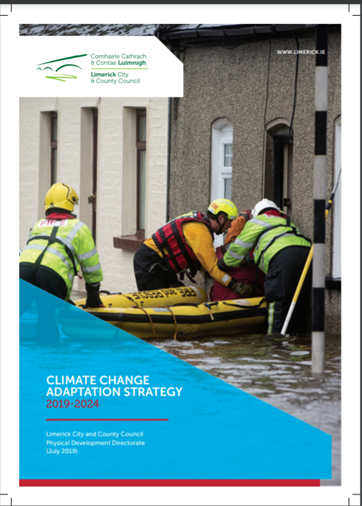
The Climate Action Plan (2021), National Mitigation Plan (2017) and National Adaptation Framework (2018) represent a renewed Government ambition that climate action requires a multi-sectoral effort nationally, regionally and locally. The Council has adopted a Climate Change and Adaption Strategy 2019-2024 to outline actions within the Council’s remit to address climate change issues such a flooding and the reduction of greenhouse gases. This Proposed LAP seeks to deliver and build on the objectives of the Climate Change and Adaption Strategy as they relate to Rathkeale.
12.2 Climate Action and Planning
Climate Action comprises two elements – (1) Adaptation and; (2) Mitigation. Adaptation is the efforts to manage the risks and impacts associated with existing or anticipated impacts of climate change, while mitigation is the efforts to reduce the emission of greenhouse gases, and reduces the severity of future climate change impacts.
Through the policies and objectives set out in the NPF and RSES, Climate Adaptation and Mitigation measures are embedded in the plan-making process. The Proposed Local Area Plan has been prepared with the purpose of integrating and implementing these policies and provisions where relevant. The approach to density, compact settlement, land use, design and movement is consistent with broader measures to address climate change in the areas of sustainable travel, green infrastructure, flood risk adaption and renewable energy sources, amongst others. Blue Green infrastructure can be used as a tool to alleviate some of the negative impacts of climate change and in some ways contribute to the prevention or slowing down this change. Mitigation measures include planting of trees, hedgerows and woodlands to clean air and assist with carbon sequestration, and the construction of surface water retention features such as ponds, lakes, or swales. The Proposed LAP can help mitigate further impact on the environment through ensuring that future development takes cognisance of the natural elements of sites and incorporates them within the design of buildings and neighbourhoods, connecting them into the wider blue green infrastructure network. Where there are no natural site features present, the potential for a landscaping plan to re-establish blue green features/infrastructure should be prepared.
The design, construction and operation of new buildings has a significant role to play in reducing energy demand and increasing energy efficiency into the future. The integration of energy efficiencies into the life cycle of all new residential and non-residential buildings, from the neighbourhood, street and individual building scale, can result in significant savings at the local level. Similarly, the concept of smart technology, construction techniques, the Circular Economy, new energy and transport solutions have critical roles in transitioning to a low carbon society to adapt and mitigate the impact of climate change.
To comply with the EU Floods Directive and to align with national guidance ‘The Planning System and Flood Risk Management Guidelines’, 2009, this Proposed LAP has taken flood risk into consideration when determining land use zoning and objectives. The Proposed Plan is also informed by the OPW – the government organisation leading flood risk management and responsible for flood relief investment nationally.
The Council ensures that proper flood risk identification, assessment and avoidance are integrated with the planning system to safeguard the future sustainable development of Rathkeale. Refer to the Strategic Environmental Screening, Appropriate Assessement and Stage 1 Flood Risk Assessment report that accompanies this LAP. The land use zoning of this Proposed LAP has been determined by applying the principles of the 2009 Guideline that: (a) flood risk is avoided where possible; (b) where avoidance is not possible, less vulnerable uses have been substituted for more vulnerable ones, and; (c) risk is mitigated and managed where avoidance and substitution are not possible.
12.4 Climate Change and Flooding Strategic Policy and Objective
Strategic Policy on Climate Change and Flooding
To address climate action and flood risk in Rathkeale in accordance with the provision of the Draft Limerick Development Plan 2022 – 2028.
Objectives: It is the objective of the Council to:
CC O1: Ensure all development proposals shall have regard to the Limerick Climate Change Adaptation Strategy (2019), any revised or forthcoming adaptation, mitigation or climate action strategies in the formulation of any plans and when assessing planning application for future developments.
CC O2: Promote the use of smart climate change, energy and carbon off-setting solutions in new developments. In the cases of large industrial, commercial or newly constructed public buildings, the incorporation of renewable technologies, such as solar energy in the design will be encouraged, subject to compliance with all relevant planning criteria. The Council encourages the NZEB standard of building or equivalent for all new development and the use of blue green infrastructure as a mechanism for surface water management and improving public realm.
CC O3:
(a) Manage flood risk in accordance with the requirements of “The Planning System and Flood Risk Management Guidelines for Planning Authorities”, DECLG and OPW (2009) and any revisions thereof and consider the potential impacts of climate change in the application of these guidelines.
(b) Require applications in areas at risk of flooding to be supported by a comprehensive flood risk assessment. All flood risk assessments should have regard to ‘The Planning System and Flood Risk Management’ (DEHLG and OPW, Nov.2009) as revised by Circular PL 2/2014, national flood hazard mapping, predicted changes in flood events resulting from climate change and the River Shannon Catchment Flood Risk and Management Plan.
(c) Minimise flood risk arising from pluvial (surface water) flooding in Rathkeale by promoting the use of natural flood risk management measures including sustainable drainage systems (SuDS), minimising extent of hard surface/paving, and smart solutions such as innovative green infrastructure.
(d) Demonstrate that future development will not result in increased risk of flooding elsewhere, restrict flow paths, where compensatory storage / storm water retention measures shall be provided on site.
CC O4:
(a) Support and co-operate with the OPW in delivering the Rathkeale Flood Relief Scheme.
(b) Support delivery of projects to reduce surface water and groundwater flood risk.
(c) Preserve riparian strips of 10m on the banks of the River Deel and other watercourses as deemed appropriate free of development ensuring adequate width to permit access for river maintenance.
Contents
Observations
Observations
Please see attached submission from the Environmental Protection Agency