1: All the street and lanes should have their names clearly signposted. The memory and history of these places is being lost.
2: Houses should have numbers or names. ...
Chapter 7 - Opportunities for Placemaking
Closed18 Jun, 2022, 8:00am - 2 Aug, 2022, 5:00pm
Limerick City and County Council is committed to the principles of place-making, universal design, and high quality public realm. These are critical aspects of good urban design of space and buildings to create viable, attractive urban areas to reside, work, invest in, and to do business sustaining a good quality of life for citizens. The Draft Limerick Plan contains an objective to prepare a public realm plan for Rathkeale.
Rathkeale has a number of assets in the town supporting better urbanism. These include Rathkeale’s strong sense of place, its’ fine 18th and 19th Century streetscape, the Square, the accessibility of services and amenities within the 10 minute walk from the town centre, the Matrix Walk and the Limerick Greenway and the range of businesses/services available in the town.
7.1 Urban Design, Place-making, Universal Design, Public Realm
Place-making refers to the collaborative approach to design public spaces, the collective assemblage of buildings, be that the road/street space, spaces between buildings, the square, public access to the riverside, walkways etc. Place-making initiatives respond to the built- heritage, natural environment, social and cultural characteristics of the town/place seeking new design solutions on principles for sustainability, longevity, universal accessibility, security and, perhaps most importantly, sustained use by the community instilling a sense of identity and community pride. Essentially, there is a collective effort by communities to reimagine and reinvent public spaces in their town.
Universal design refers to the design of buildings and spaces on the principle of accessibility of all abilities regardless of age, physique or mobility, and the urban environment is understandable, legible and easily to move around in and safe for the individual.
Public realm considers the design and materials used in all areas that the public has access to, including public buildings, public spaces, streets, parks, open spaces, and civic spaces such as the Square.
The concepts above are interrelated and when successful applied can create responsive, functional, inclusive, living urban environments instilling a sense of community pride - a place that people want to visit, use, and interact socially informally, or more formally at civic events in safe, aesthetic open spaces.
National guidance promoting the principles above should be incorporated into the design stage of development include;
- Sustainable Residential Development In Urban Areas, Guidelines for Planning Authorities, DEHG (2009);
- Urban Design Manual - A Best Practice Guide (2009);
- Sustainable Urban Housing: Design Standards for New Apartments, Guidelines for Planning Authorities (2018);
- Urban Development and Building Heights, Guidelines for Planning Authorities (2018);
- The Design Manual for Urban Roads and Streets, DTTS and DECLG (2019);
- Building for Everyone: A Universal Design Approach.
- Town Centre First, Department of Rural and Community Development and Department of Housing, Local Government, and Heritage, 2022.
In particular, reference should be made to the 12 criteria of the Urban Design Manual in future design proposals and the relevant provisions, including the Development Management Standards of the Draft Limerick Development Plan 2022 – 2028.
7.2 The 10-Minute Town Concept and Town Centre First Approach
This Plan aligns with higher-level spatial plans seeking future development in settlements on the principle of the ‘10 Minute’ Town concept, whereby a sustainable compact settlement, such as Rathkeale, provides a range of community facilities, services, recreational and cultural amenities and employment opportunities that are accessible in short walking and cycle timeframes from homes, or accessible by public transport services connecting people to larger-scaled settlements such as Limerick City or Newcastle West. Re-use of buildings, infill, re-purposing of under-used lands have the potential to deliver the concept in Rathkeale, as areas identified in this Proposed Plan are in the town centre or within 10-minute walking of the town centres and services.
The most recent government policy publication, Town Centre First seeks to attract vibrant communities in urban settlements, including smaller towns such as Rathkeale to encourage families back into living in the heart of the towns through place-making, good quality urban design and sustainable mobility.
This Proposed Plan promotes the concept of a thriving town centre, with a strong commercial and social function and seeks to consolidate the town rather than encourage sprawl. This can be achieved through sensitive restoration of buildings, including small local shops or creative workspaces that conserve traditional shopfronts, repurposing historic buildings to respond to modern demands, such as changing demography, work practices, and investing in a high quality pedestrian/cyclist friendly public realm and attractive public spaces where people can gather socially. This Plan includes 10.6 hectares of land zoned as Town Centre.
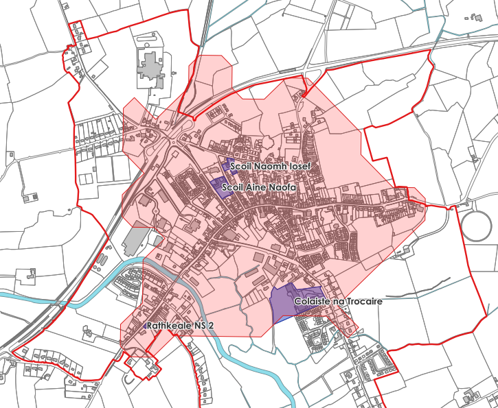
Figure 8: Map of 10 Minute Town Concept Analysis of Rathkeale
Limerick City and County Council carried out a Health Check in Rathkeale in October 2021, the Health Check is a useful tool which establish a baseline, to help monitor and drive the development of the town centre. The Health Check establishes the use of each building and also takes account of vacancy and dereliction. The land use map presents a mixed town core with a clearly delineated town centre where commercial uses give way to residential dominance. The urban form is very distinctive along the Main Street. The results of the Health Check demonstrates a variety of uses in Rathkeale including Enterprise and Employment such as ABP Meats and Design Pro, financial and business institutions, both convenience and comparison retail units.
Limerick City and County Council have been proactively working to address vacancy and dereliction across Limerick and have been working with landowners throughout Rathkeale to address these issues. As outlined above the residential vacancy in Rathkeale was recorded as 9.48% in the Health Check Survey carried out in October 2021, commercial vacancy was significantly higher at 27%. Limerick City and County Council recently acquired the Ballywilliam Estate on the Ballingarry, which is an unfinished estate of 33 dwelling houses, in various stages of construction and the Council are currently assessing options to address the issues on site.
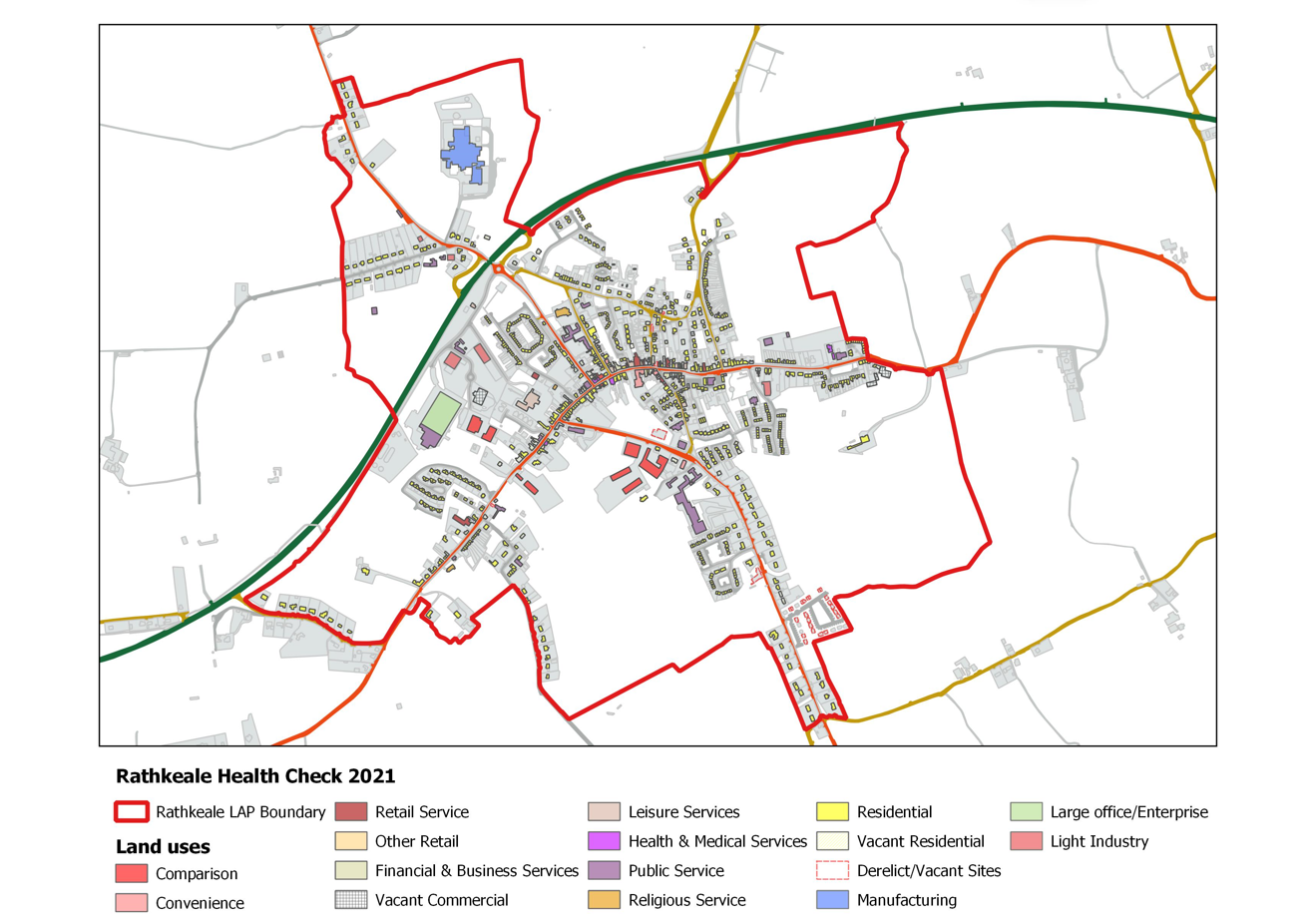
Figure 9: Town Centre Health Check for Rathkeale – October 2021
This Plan identifies five opportunity areas that have the potential for opportunities to sustain community vitality, a positive public realm experience, or have potential for adaptive re-use. The Council seeks to capitalise on the existing assets in these areas, be that natural biodiversity and amenity, location or the historic built heritage, including the vernacular streetscape.
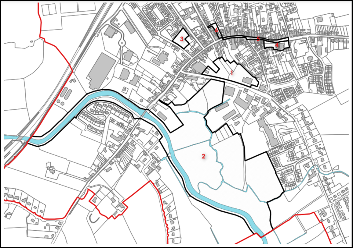 Figure 10: Opportunity Areas in Rathkeale
|
Opportunity Area |
Comment |
|
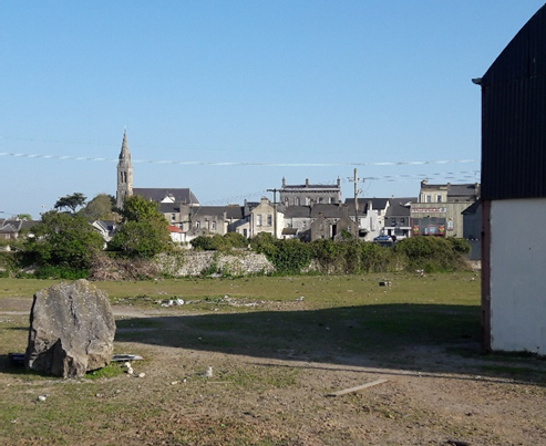
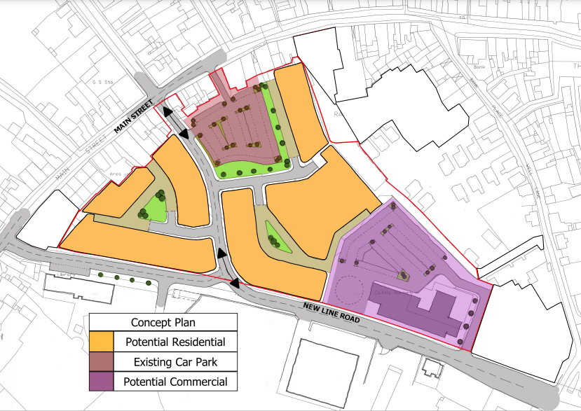
Area 1 – Former Mart, New Line |
|
|
Opportunity Area |
Comments |
|
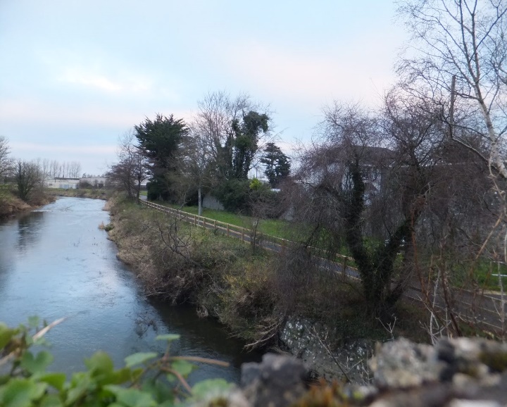
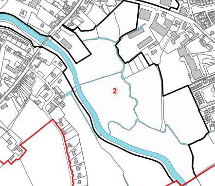
Area 2 - Matrix Riverside Walk |
|
|
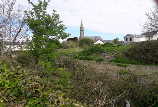
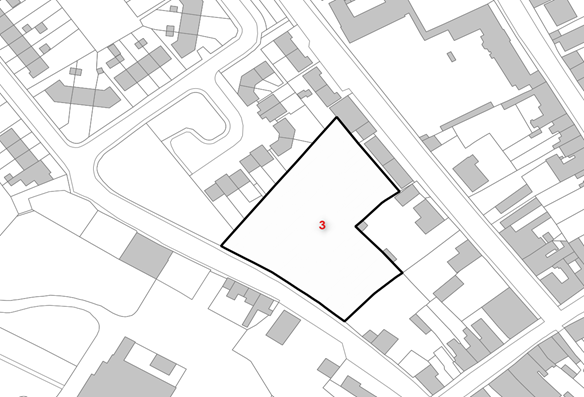
Area 3 – Old Road/Backlands of New Road |
|
|
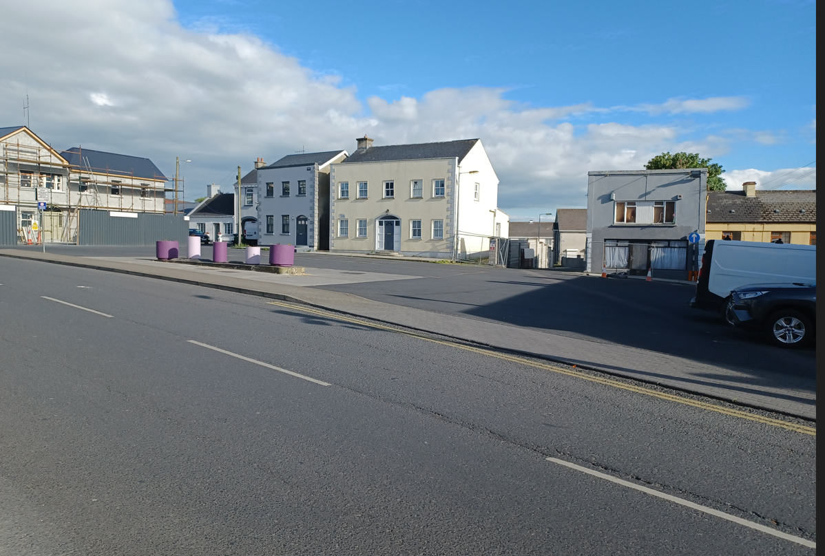
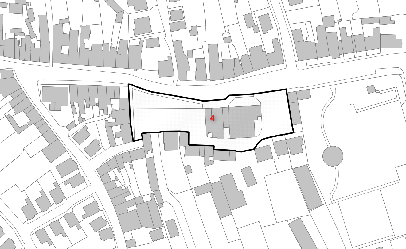
Area 4 – Market Square |
|
|
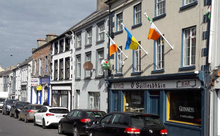
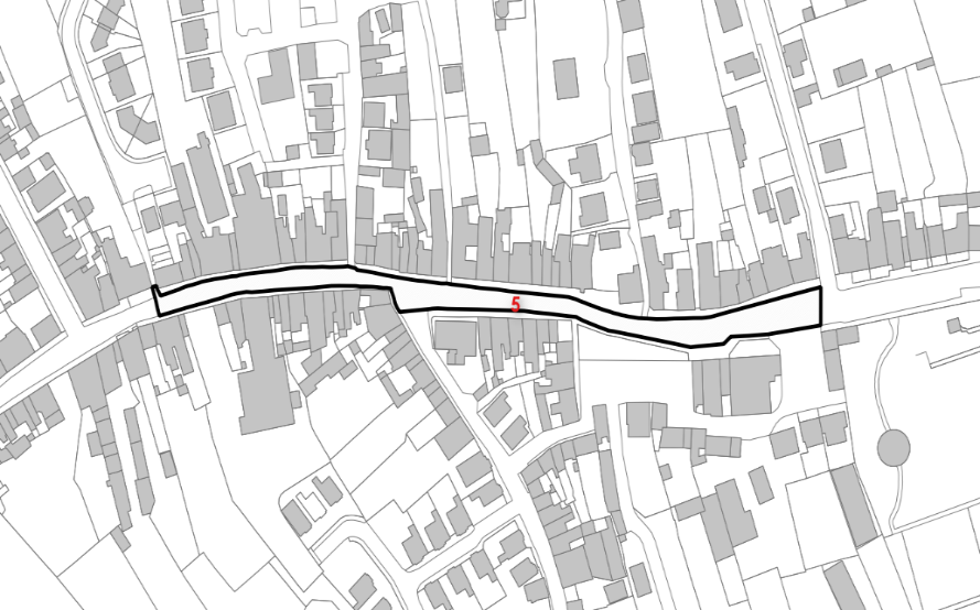
Area 5 – North Main Street Streetscape |
|
|
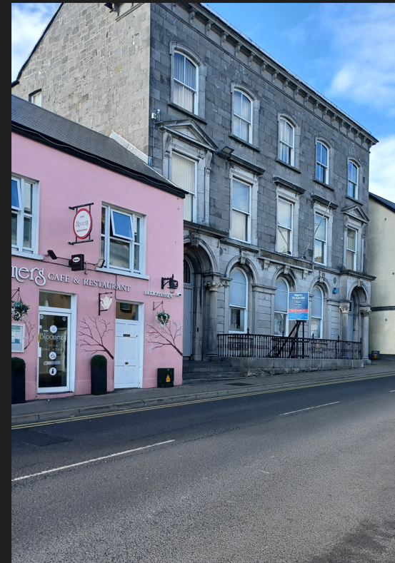
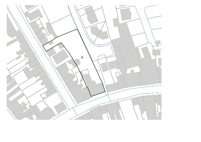
Area 6 – Former Bank of Ireland |
|
Table 2: Opportunity Areas for Public Realm and Place-making
7.5 Opportunities for Place Making - Strategy and Objectives
Strategic Placemaking Policy
To ensure that new development in the town centre and in particular the opportunity areas comprises the highest of qualitative and design standards, complimenting the existing historical built fabric, or natural heritage, sustaining Rathkeale as a town in which to live, work, invest in and do business.
Objectives: It is an objective of the Council to:
RD 1:
(a) Promote high quality place-making and public realm in accordance with the Draft Limerick Development Plan 2022 – 2028, including the Development Management Standards, any replacement thereof and any relevant Section 28 Guidance. All development shall demonstrate climate resilience measures to climate-proof critical infrastructure.
Contents
Observations
Observations